

People in Staffordshire interested in their local and family history are getting a glimpse of the county’s past thanks to a new project.
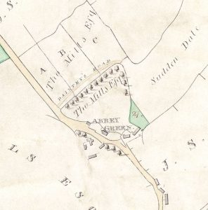
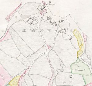
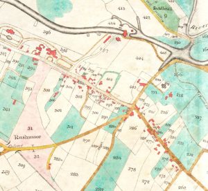
Staffordshire Archives and Heritage service have digitised their collection of historic enclosure maps. Dating from between 1738 and 1884, the maps are large scale and very accurate and show the new landscape of fields, roads and buildings. As well as being great sources of information for local history, many of the maps are beautifully drawn.
Around half of the 200 maps are now available to view online at www.staffspasttrack.org.uk, with the rest to follow in the coming weeks.
The project was made possible by the Friends of Staffordshire & Stoke-on-Trent Archive Service with a grant from Midlands Ancestors’ Kemp Legacy Fund.
Richard Totty, Chair of FoSSA said: “The quality of digitisation is excellent. They are an excellent source for local and family historians and much underused in the past so this will give them more prominence.
“They are a very good complement to the tithe maps as some are much earlier and others such as those from Alstonefield parish cover areas where there is no tithe map.”
Enclosure was the process of dividing common land into enclosed fields. This started in the medieval period but most surviving documentation relates to the enclosures of the 18th and 19th centuries.
The maps are part of Staffordshire Record Office’s Designated collections. The funding paid for Staffordshire-based digitisation specialists ICAM Archive Systems Ltd to carry out specialised scanning of the maps.
The digitisation is part of the wider Staffordshire History Centre project which is seeing the construction of a new heritage centre in Stafford along with an extensive programme of activities to get more people interested in the county’s history and heritage.


